The port of Port Alegre, despite having river features, is classified as a seaport and it has operating capacity of up to 3 long-haul ships simultaneously.
Historical Facts
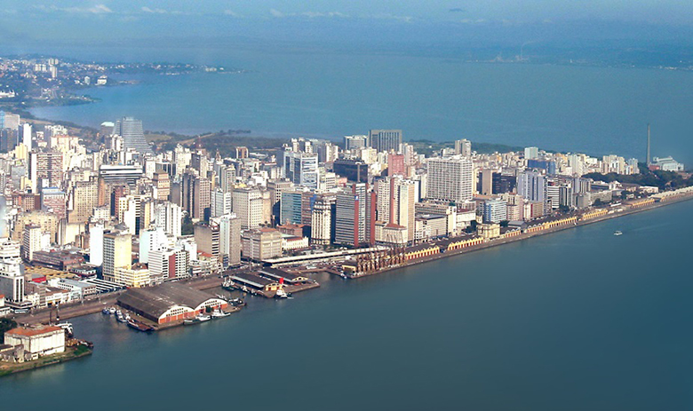
The port of Port Alegre, despite having river features, is classified as a seaport, as Resolution No. 2969 -ANTAQ of 4 July 2013. It maintains eight kilometers of wharf, divided between the Mauá Pier, Navegantes and Marcilio Dias. Its structure involves 25 stores with 70 thousand square meters, a total area 450 thousand square meters. Since the first half of 2005, the area of operation of public port is concentrated in Navegantes pier, which is governed by international standards ISPS-CODE safety, since 2010. It has operating capacity of up to 3 long-haul ships simultaneously. Since the end of 2012, the port of Capital participates in the program developed by the federal government, called Paperless Port - PSP, which concentrates all its port data, sharing them with consenting agencies (Federal Police, Federal Revenue, VIGIAGRO, ANVISA, Navy of Brazil, among others). The port zoning of the state capital offers distinct areas for multipurpose terminals, grain, fertilizer and general cargo. Over the past five years, the port of Porto Alegre with the terminals Private moved about 6 million tons / year in products such as offshore mooring cables, fertilizer, salt, vegetables grains, electrical transformers and cellulose.
Details
Area:8.184km²
Extenção do Cais: 2km CODESP 11.600 Privativos 1.413
Berços:18
Fonte: Página oficial do Porto do Rio Grande.
Extension of the wharf:8.028m
Mauá wharf: 3.240m
Navegantes wharf:3.268m
Marcílio Dias wharf: 1.413m
Berths:33
Source: Official website of the Port of Porto Alegre